


Flooding threatens Jacksonville as city officials try to do something about it
JACKSONVILLE, Fla. — October 24, 2026. Jacksonville is bracing for potentially significant coastal flooding this weekend as strong northeast winds, unusually high tides and dangerous ocean conditions threaten neighborhoods, roads and businesses across Duval…
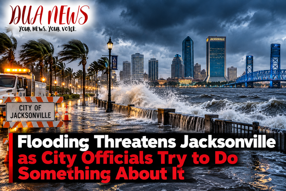
JACKSONVILLE, Fla. — October 24, 2026. Jacksonville is bracing for potentially significant coastal flooding this weekend as strong northeast winds, unusually high tides and dangerous ocean conditions threaten neighborhoods, roads and businesses across Duval County.
City officials are taking emergency precautions as the National Weather Service warns that some coastal and riverfront communities could experience moderate to locally major flooding through Monday, October 26.
Although the weather system is not a named tropical storm, officials say its coastal impacts could resemble those of a tropical storm.

City of Jacksonville Activates Emergency Preparations
The City of Jacksonville has announced that the Duval County Emergency Operations Center will move to partial activation Saturday evening.
The decision means emergency management personnel will be stationed at the center to monitor conditions, coordinate with response agencies and issue warnings if the situation worsens.
Jacksonville’s Emergency Preparedness Division is working closely with the National Weather Service to track the developing weather system.
The Jacksonville Fire and Rescue Department is also positioning specialized swiftwater rescue teams and emergency road-access crews to respond quickly if flooding traps residents or blocks important routes.
Officials are particularly concerned about the combination of strong winds and exceptionally high astronomical tides, commonly known as king tides.
Which Jacksonville Neighborhoods Are Most at Risk?
According to the city’s official advisory, flooding could affect several vulnerable neighborhoods and communities along the Atlantic coastline, Intracoastal Waterway and St. Johns River.
Among the areas identified as particularly susceptible are San Marco, Riverside, the Northbank near Hogans Creek and Ken Knight Drive.
Along the Atlantic coast and Intracoastal Waterway, water levels could rise approximately 2.5 to 3.5 feet above normally dry ground.
Along the St. Johns River and its tributaries, flooding could reach approximately 2 to 3 feet in locations already prone to tidal flooding.
At those levels, water could cover coastal and riverfront roads, enter low-lying properties and disrupt access to some neighborhoods.
The highest water levels are expected around high tide, particularly Sunday and Monday mornings.
Strong Winds Could Cause Additional Problems
Flooding is not the only concern.
Forecasters warn that northeast wind gusts could reach 40 to 45 mph along parts of the coastline Saturday afternoon and into Sunday.
These winds could bring down tree limbs, damage vulnerable structures and cause scattered power outages.
Periods of locally heavy rain could make flooding worse, particularly if downpours coincide with high tide.
The National Weather Service has issued Coastal Flood Warnings for affected areas, along with wind and marine weather advisories.
Jacksonville Beaches Face Dangerous Conditions
Residents and visitors planning to visit Jacksonville Beach, Neptune Beach or Atlantic Beach are being urged to exercise extreme caution.
Waves could reach 7 to 11 feet along portions of the coastline, with even higher seas offshore.
The National Weather Service is also warning of dangerous rip currents and significant beach erosion.
These conditions could remain hazardous through Monday and potentially into next week.
Officials strongly discourage entering the ocean during periods of dangerous surf.
What Is the City Doing to Protect Residents?
Jacksonville’s emergency preparations focus on coordinating public safety resources and responding rapidly to developing problems.
The city’s measures include closer weather monitoring, partial activation of the Emergency Operations Center, positioning specialized rescue teams and preparing crews to reach areas affected by flooding.
The Jacksonville Transportation Authority is also monitoring conditions and will announce any changes to transit services through its official channels.
Residents are encouraged to secure outdoor objects, prepare for possible power outages and take precautions if their homes or businesses are located in flood-prone areas.
The city has not announced a countywide mandatory evacuation in the emergency preparedness statement reviewed for this report.
What Should Residents Do?
Authorities are urging residents to avoid flooded roads and never drive around barricades.
Even shallow-looking floodwater can conceal dangerous road conditions.
People living in low-lying neighborhoods should consider moving vehicles to higher ground before the highest tides arrive.
Residents should also avoid fallen power lines and report hazardous conditions to the city.
Downed trees and power lines that create safety hazards can be reported by calling 904-630-CITY (2489).
For official emergency information, residents can visit JaxReady.com.
When Will the Threat End?
The current Coastal Flood Warning is scheduled to remain in effect through Monday evening, October 26.
However, hazardous surf, rip currents and beach erosion could persist beyond that period.
The National Weather Service expects the greatest flooding threat around the highest tides, especially Sunday and Monday mornings.
The severity of flooding will depend on wind strength, tide levels and the timing of any additional rainfall.
Jacksonville Braces for a Difficult Weekend
For Jacksonville residents, the weekend could bring more than ordinary autumn rain.
The combination of persistent northeast winds, elevated tides and rough ocean conditions has prompted city officials to prepare for potentially serious flooding.
While the full extent of the impact remains uncertain, emergency officials are urging residents to take the warnings seriously.
DUANEWS — Your News. Your Voice.
Conversation 0